Bloomhouse Master Plan
Master Plan & Architecture Design
Professional (2019-2021)
Overview
Office : BIG Architects
Team : Bjarke Ingles, Leon Rost, Giulia Frittoli, Lawrence Mahadoo, Gil Kang, Cristina Medina-Gonzolez
Location : East Palo Alto, California
Status : Under Construction
Tools : Rhino, Grasshopper, Vray for Rhino, Enscape, Illustrator, 3D Printing
Phases : Concept Design, Design Development
Renderings
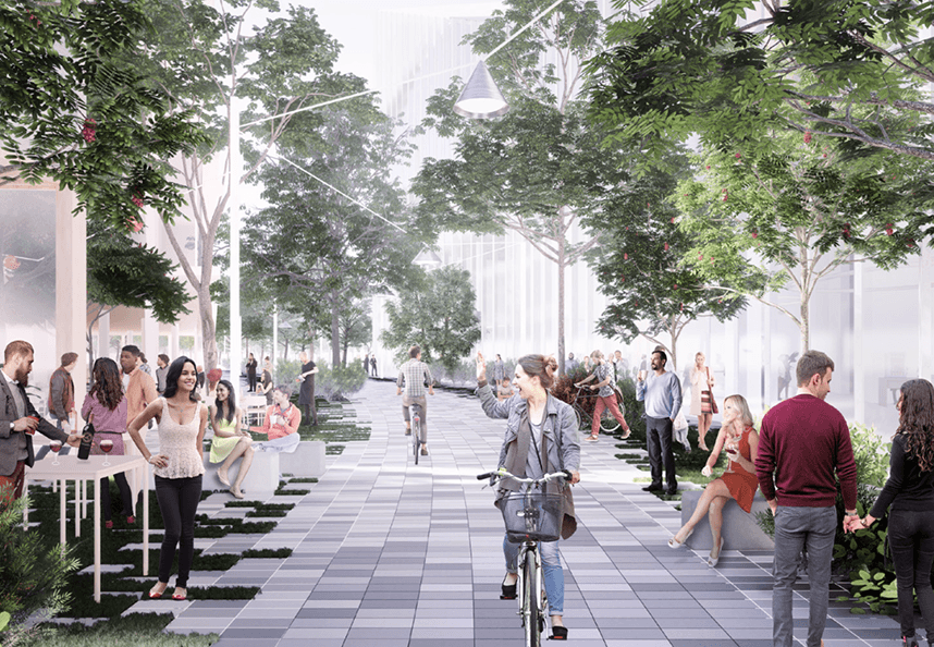
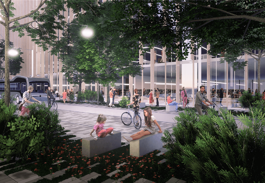
All renderings were 3D modeled and rendered by our team of 5 using Rhino, Grasshopper, Enscape and V-ray.
Rendered Typology Axon Diagrams
Below are axon diagrams of unique identities for each program. Assigning each program with a typology would help people navigate through Bloomhouse.

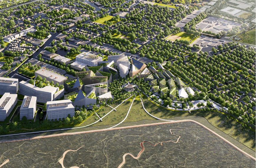
Aerial Renderings of the Site

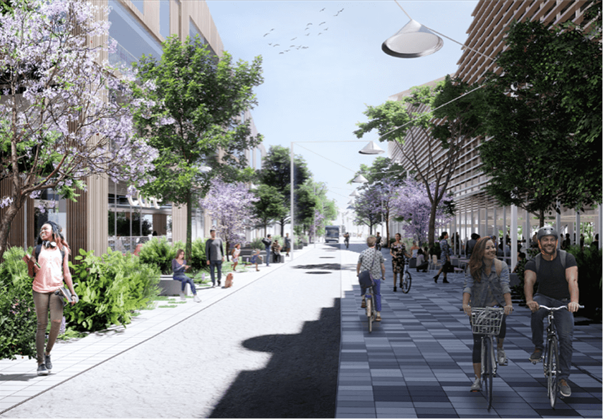
Renderings of Streetscapes

Project Background
Bloomhouse is a vision for the future of East Palo Alto’s (EPA) waterfront. It is a co-created masterplan with the local community towards a more equitable and sustainable future. It thrives as a place to cherish the city’s rich and diverse cultures by offering a new platform for their growth. Bloomhouse explores a new urban model -- a sustainable development that prioritizes the local community’s desires and needs, while maximizing the fertility of the land through lush productive landscapes and regenerated ecology.
The site’s challenges stem from a history of political decisions that have left EPA’s community disadvantaged, limiting their access to job opportunities, education, affordable housing, green open-spaces and leisure. Additionally, regional infrastructure in EPA has created physical barriers, reducing mobility to neighboring cities and creating health and safety hazards through traffic and pollution. As the project “blooms”, it will tackle the site’s and community’s challenges by enabling a new way of moving, living and growing.
Community Engagement
We met with the East Palo Alto Community a few times and surveyed everyone asking what type of space they felt they needed for the future of EPA’s waterfront. It was clear that they wanted more affordable housing and public space filled with nature, sports fields, open flex spaces for concerts and markets, and a large shopping area.

Interactive Diagrams
After a few weeks, we met with the EPA community again. Below are a few interactive posters out of many that were done in collaboration with the community. We had initially split the site into zones (Housing, Business, Industry, and Green Space) based on our research and our initial conversations. This exercise allowed the community to imagine their hopes for the site and organize the site with specific programs and how they were all connected to each other.
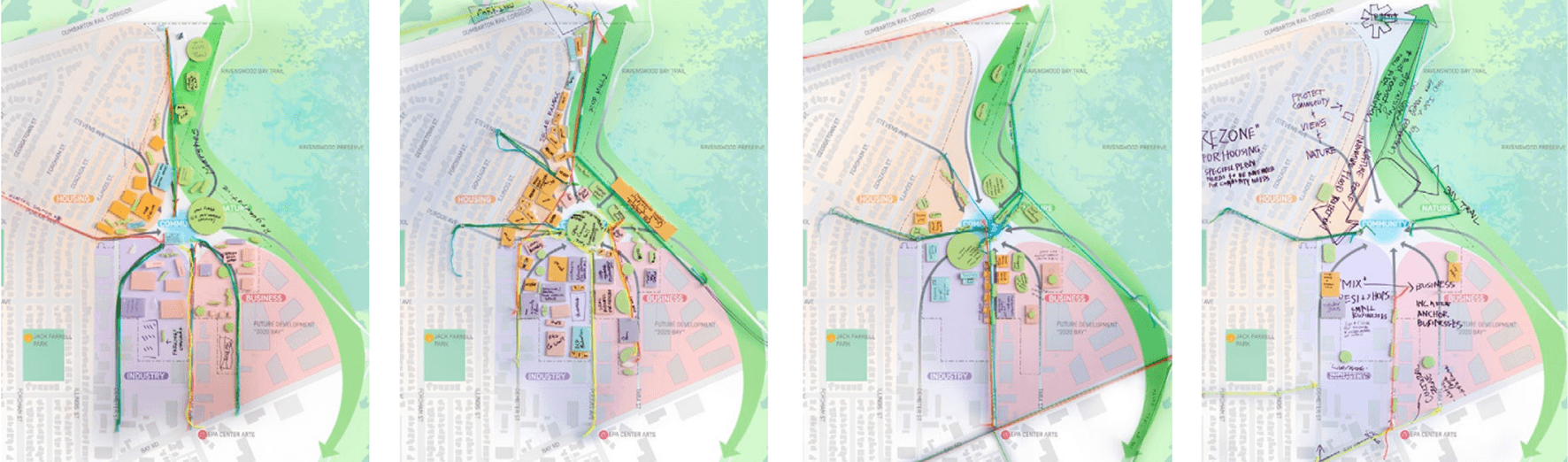
What We’ve Heard
On the left, we compiled everything we saw from all of the interactive diagrams into one diagram. On the right is a circulation diagram we created that shows the different ways the city could be connected to the site. There was a consensus that Bloomhouse would be be completely pedestrian friendly and would only include slow-mobility vehicles such as bikes and a single bus route.

Concept Diagrams
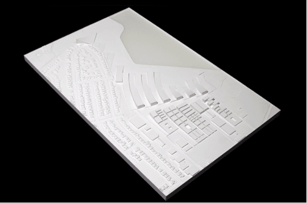
Preliminary Design Studies
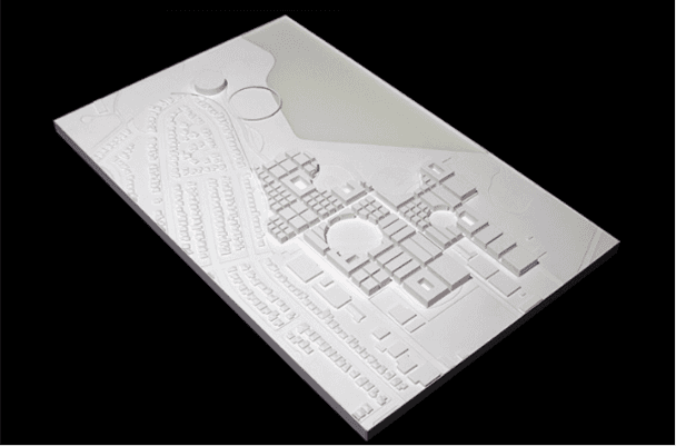
Below are process 3D printed studies of the Bloomhouse Master Plan that we printed for client meetings. We focused on finding different methods of creating nodes and circulation while organizing Housing, Business, Industry, and Public Green Spaces.
Circle Nodes
Circular Plaza
Rectangular Plaza

Mixed Grid
Star Plaza

Pinwheel Plaza
Bubbles
Zipper
Concept Build-Up Diagrams
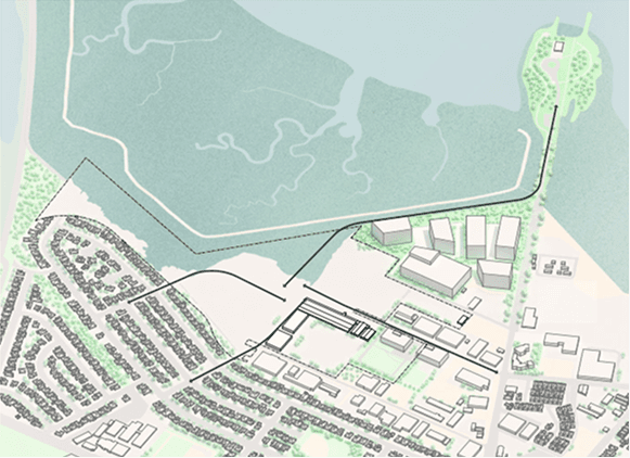
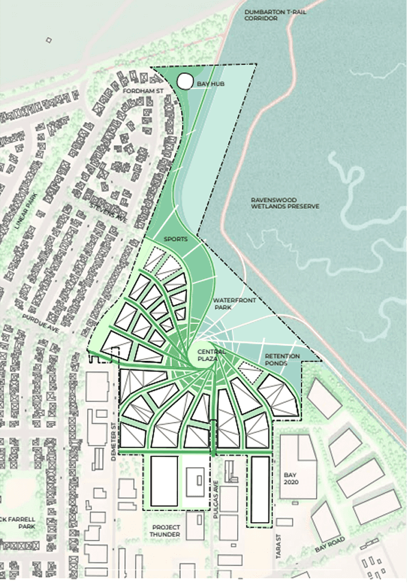
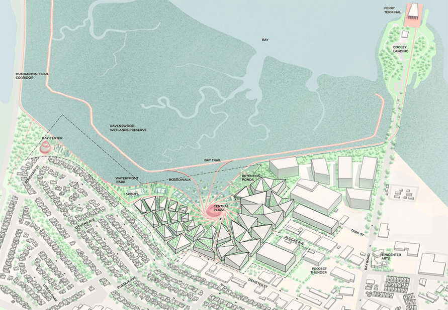
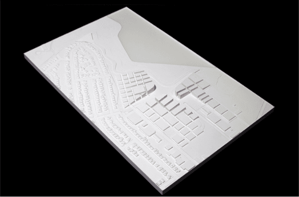
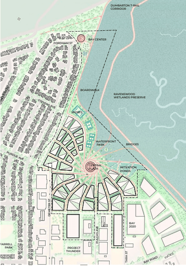
Main Site Access
The main connections are extended into the site, strengthening the link between the city of East Palo Alto to the West via Purdue Ave, to the South via Pulgas Ave and along its waterfront in connection to the future ferry landing.
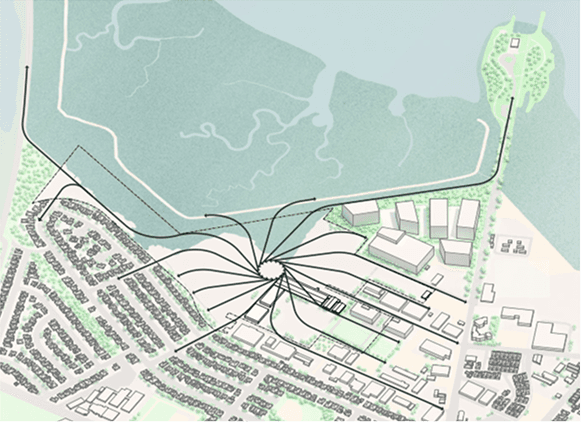
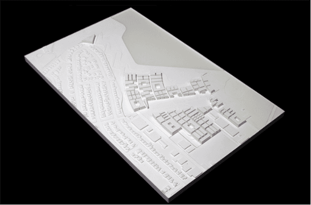
Converging Grids
The existing urban grids and minor connections are consequently extended towards the new center of gravity. The converging grid defines a twist that wraps the existing streets towards the bay and with each other.
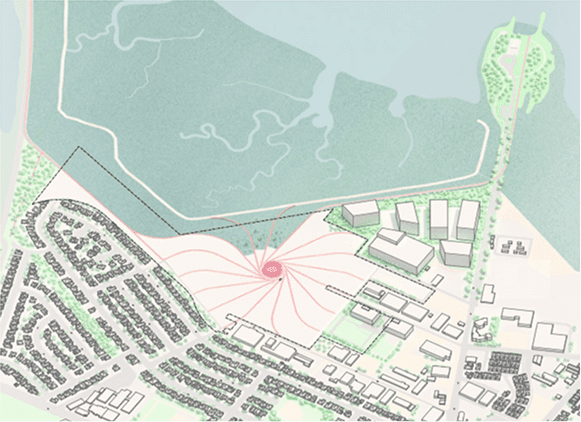
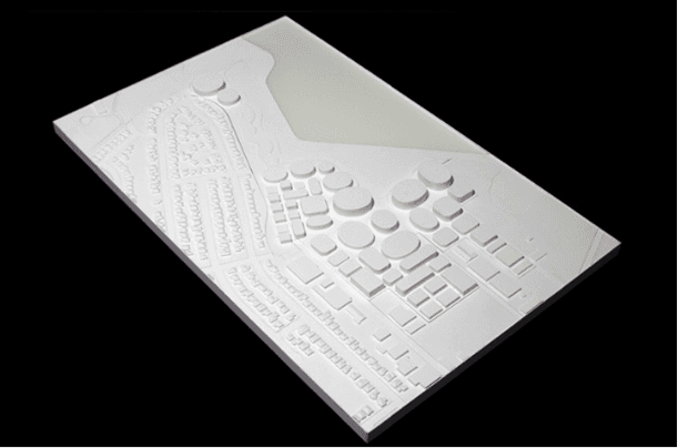
Central Gathering Place
The converging grid defines a new civic center for the city of East Palo Alto, a central destination and a place for people to gather and connect.

Park & Green Streets
The rich nature of the bay spirals around the center plaza, creating a new green network that extends out to the rest of East Palo Alto.

Waterfront & Ferry Landing
Along the exiting tidal marsh, a revitalized waterfront park connects the site North-South, linking to Cooley Landing and the Dumbarton Rail Corridor.
Buildings & Passageways
To allow for ground-floor porosity, the blocks can be divide in different buildings with different sizes depending on program and typology.
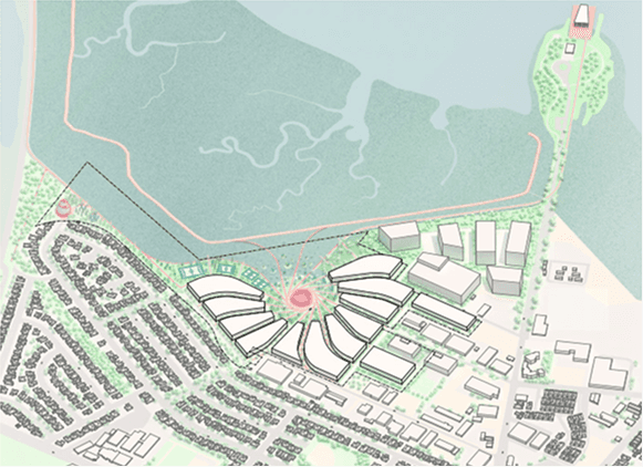
Urban Blocks
These new blocks frame the plaza creating an intimate public space open towards the bay.
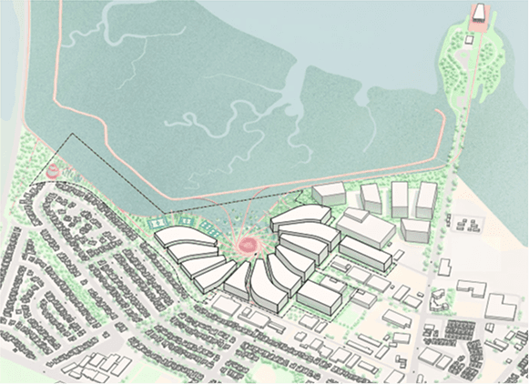
Gradually Distributed Heights
The heights are distributed gradually to respect the surrounding context: lower towards the residential neighborhood, mid-rise in the warehouse district, and higher at the waterfront.

Buildings & Passageways
To allow for ground-floor porosity, the blocks can be divided into different buildings with different sizes depending on program and typology.

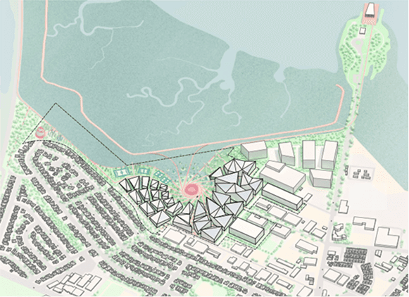
Faceted Buildings & Folded Roofline
Building massing becomes faceted in response to the street curvatures well, the roofline tapers above the street wall allowing for sunlight into the plaza and the streets.
Solar Panels Facing South-West
Diagonally-oriented pitch roofs become ideal for solar panels facing South-West and South-East
Green Terraces Facing the Bay
The opposite roof face turns into green terraces facing the bay, creating a series of outdoor spaces for amenities, gardens and flexible uses.
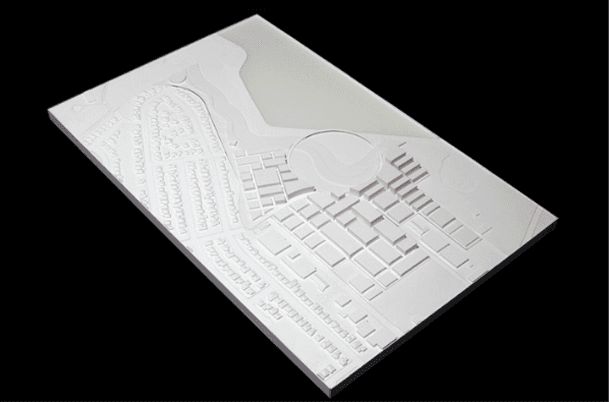
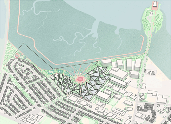
Final Axon of Bloomhouse Site
Aerial Rendering of Bloomhouse Site

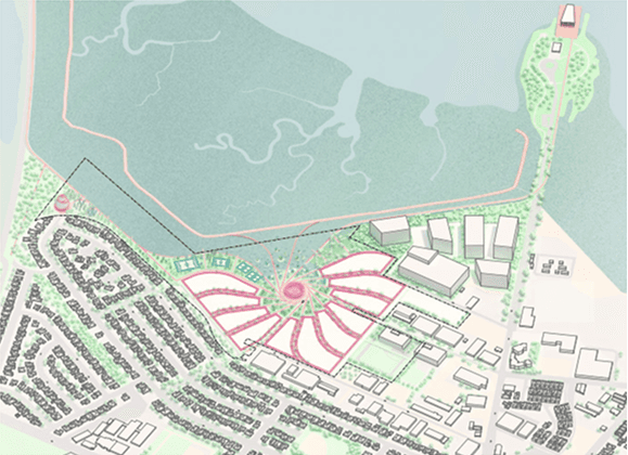
Final Site Plan
Circulation Plan

Public Space Plan