River Ring Master Plan
Architecture & Master Plan Design
Professional (2019-2021)
Overview
Office : BIG Architects
Team : Bjarke Ingles, Daniel Sundlin, Tony Shiber, Max Moriyama, Dana Lei
Location : New York City, NY
Status : ULURP
Tools : Rhino, Grasshopper, Enscape, Illust rator, Photoshop
Phases : ULURP
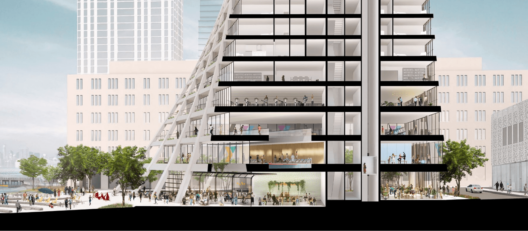
Diagram

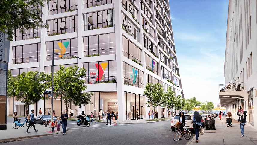
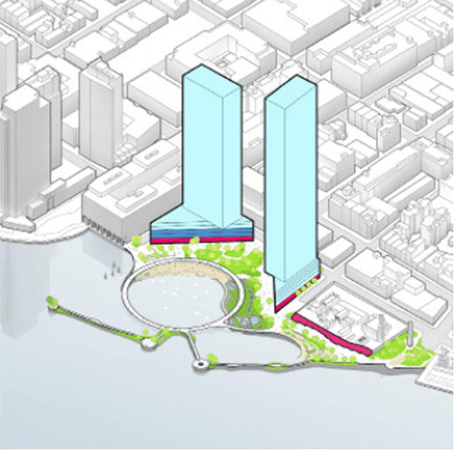
Community-Oriented Programs on the ground floors to create a more public waterfront space for the community and acts as a gateway towards water.
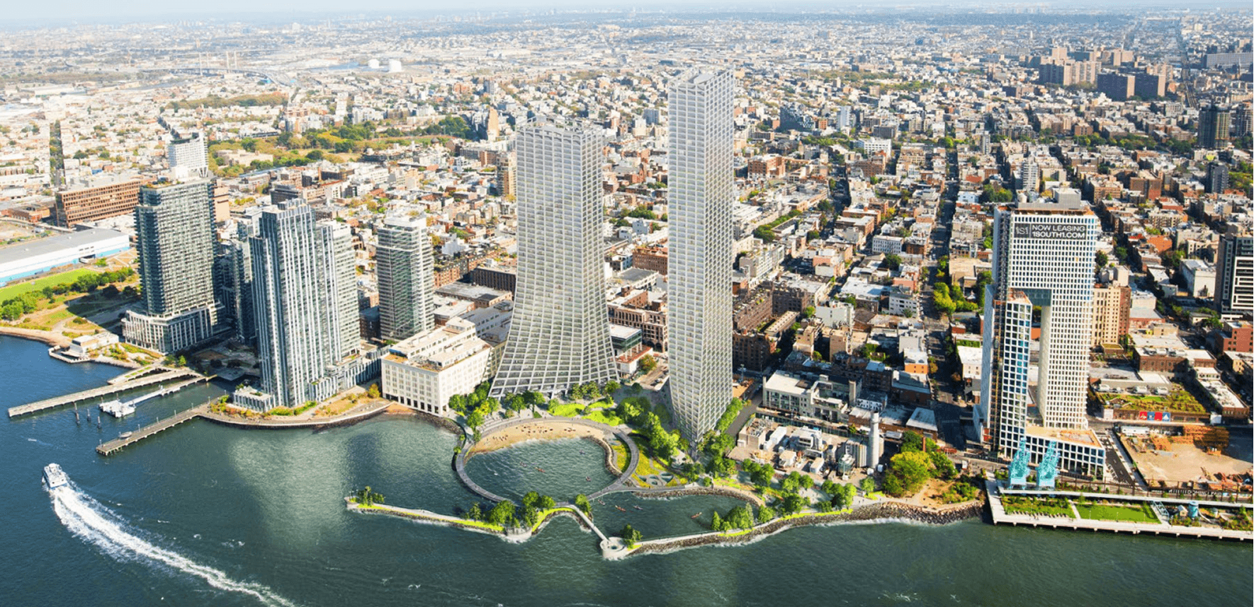
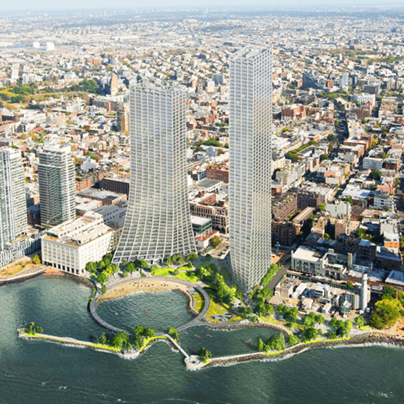
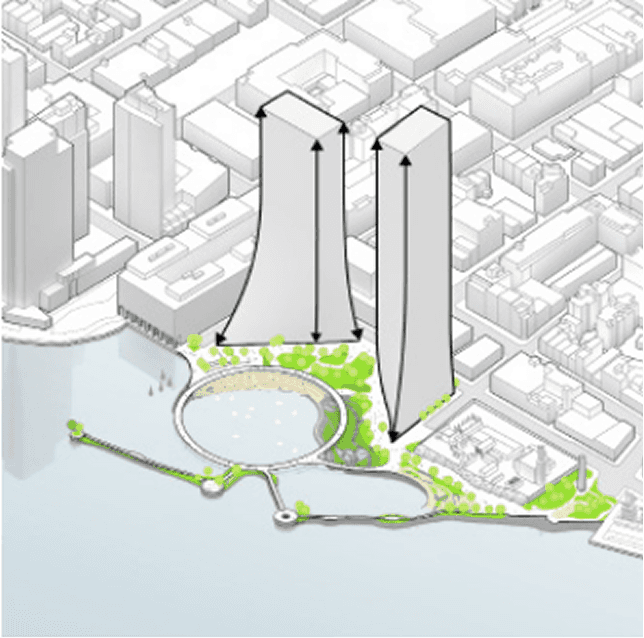
Residential Massing is added. The towers are oriented to limit view obstruction from the neighborhood and to maximize the Metropolitan Avenue view corridor.
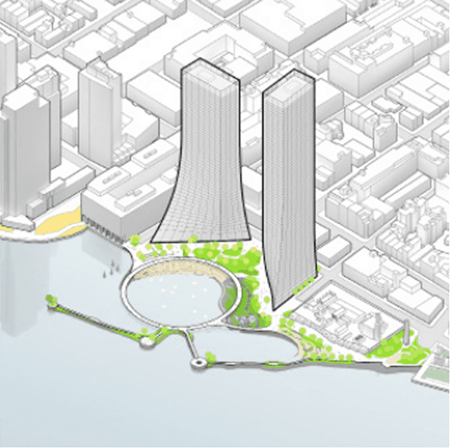
The podium is blended with the tower to soften the relationship between the building and open space while maximizing the views from the Metropolitan Avenue Corridor.
The master plan seeks to enhance the connectivity between public and waterfront, restore natural habitats, and elevate the standards for urban waterfront resiliency.
Project Background
River Ring Master Plan is a mixed-use development on the waterfront in Williamsburg, Brooklyn and is a collaboration between BIG and James Corner Field Operations.
As part of an evolving Brooklyn waterfront, the River Ring Master Plan is an extraordinary opportunity to provide a new model for urban shorelines. This vision will enhance access and connectivity of the public waterfront, restore natural habitats, elevate the standard for urban waterfront resiliency, and transform the way New Yorkers experience the East River with a living waterfront and ground-breaking mixed-use development. The River Ring will complete the continuous public waterfront that stretches from Domino Park to Bushwick Inlet Park, addressing a major missing link between Williamsburg and Greenpoint. The water’s edge extends into the city to offer the community a natural respite, and provide additional habitats for native species. Waterfront infrastructure and open space will feature accessible breakwaters and nature trails, beaches, marshes, wetlands, and a tidal basin that dissipate wave action from storm surges and create calmer waters for safe in-water recreation—a rare opportunity for New Yorkers. The River Ring seeks to maximize affordable housing, minimize the burden on existing infrastructure, and employ architectural strategies responsive to site conditions and constraints. In addition to over 70,000sf of public-facing programs, the two mixed-income buildings will provide 1,050 total units of housing, 263 of which will be below-market rate.
Renderings